


col du rabout devoluy 08 2022

jacquesduchesne
User

Length
15.2 km

Max alt
1891 m

Uphill gradient
656 m
Km-Effort
24 km

Min alt
1274 m

Downhill gradient
646 m
Boucle
No
Creation date :
2022-08-01 06:24:21.095
Updated on :
2022-08-01 12:31:04.104
6h06
Difficulty : Very difficult

FREE GPS app for hiking
 SityTrail
IGN / Geographical institutes
SityTrail Plus
The world is yours!
About
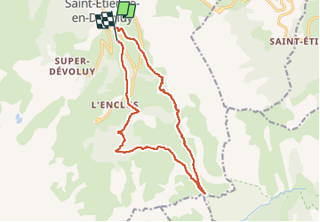
Trail Walking of 15.2 km to be discovered at Provence-Alpes-Côte d'Azur, Hautes-Alpes, Le Dévoluy. This trail is proposed by jacquesduchesne.
Positioning
Country:
France
Region :
Provence-Alpes-Côte d'Azur
Department/Province :
Hautes-Alpes
Municipality :
Le Dévoluy
Location:
Saint-Étienne-en-Dévoluy
Start:(Dec)
Start:(UTM)
733461 ; 4952394 (31T) N.
Comments